


Kane County Woman Claims Allstate Threatens to Cancel Insurance Due to Google Earth Images
### Illinois Woman Challenges Insurance Policy Over Unannounced Aerial Property Photos
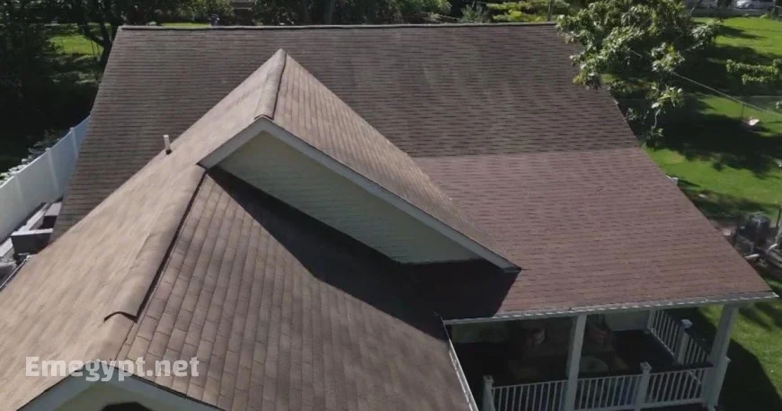
An Illinois resident, Roseanna Castillo, recently found herself at odds with Allstate Insurance after the company threatened to cancel her coverage based on unannounced aerial photos of her property. The Kane County homeowner was informed through a letter that her roof exhibited “granular loss,” a determination made using images captured via Google Earth.
### Unregulated Drone and Aerial Surveillance for Insurance
Castillo was given a tight deadline and the ultimatum of either replacing her roof at an estimated cost of $18,000 or submitting her own photographic evidence to prove its condition. “This is an unsolicited inspection on my home. I never asked for this,” Castillo stated, expressing her frustration over the situation.
Consumer advocate Amy Bach revealed that the use of drones and aerial surveillance by insurers is becoming more prevalent, yet remains largely unregulated. “They can take pictures whenever they want, they don’t have to give notice to the homeowner,” Bach explained, cautioning against the potential for technological inaccuracies.
### Customer Complaint Leads to Policy Reinstatement
In an unexpected turn, Castillo filed a complaint with the state. Soon after, Allstate withdrew the requirement for roof replacement without needing additional proof. Castillo had also contacted CBS and informed her insurer about her complaint to the Illinois Department of Insurance. Consequently, her policy will renew as usual in November, without conditions.
In similar situations, policyholders are advised to ask insurers for photographic evidence. Should they refuse, filing a complaint with the Illinois Insurance Department is recommended.
### Insurance Industry’s Defence of Aerial Inspections
An Allstate spokesperson clarified that drones and artificial intelligence were not employed in Castillo’s case, emphasizing that aerial imagery is used to improve customer experience, ensure pricing accuracy, and offer less intrusive inspections. The Insurance Information Institute also supported the practice, highlighting its efficiency, cost-effectiveness, and the non-intrusive nature of aerial inspections compared to traditional methods.
“Aerial inspections provide vital data for making prudent underwriting decisions and can highlight areas that may require improvements by the homeowner to maintain coverage,” the Institute added.
### Recommendations for Homeowners
- Request photographic evidence from your insurer if aerial images are used.
- Immediately file a complaint with the Illinois Insurance Department if there are disputes.
- Stay informed on the technological methods used by insurers to ensure accurate and fair assessments.


