


Imelda Intensifies as US Southeast Feels the Impact While Bermuda Braces for Twin Hurricane Threats
Strengthening Tropical Storm Imelda Turns East to Spare U.S. Coast
Imelda’s Impact on the Southeast Coast
Tropical Storm Imelda is intensifying north of the Bahamas as it begins its eastward turn, sparing the U.S. coast from a direct strike. Despite this, the storm is causing hazardous conditions along the Southeast coast, including dangerous surf, rip currents, coastal flooding, and beach erosion.
Bermuda Braces for Dual Storms: Hurricane Humberto and Imelda
Bermuda is facing an unusual threat from both Hurricane Humberto and Tropical Storm Imelda this week. Humberto, which briefly strengthened into a Category 5 hurricane with 160 mph winds on Saturday, is now a sizable Category 2 hurricane positioned only a few hundred miles east of Imelda. The large size of Humberto will exacerbate hazards for U.S. beaches by driving deadly rip currents and large waves further north along the East Coast than Imelda would on its own.
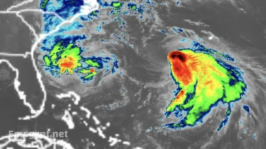
Imelda’s Recent Path and Current Status
After moving away from the Bahamas on Monday evening, Imelda left behind heavy rain, tropical storm-force winds, and storm surge over the islands. By early Tuesday, Imelda had sustained winds of 70 mph and was located about 750 miles west-southwest of Bermuda, according to the National Hurricane Center. The storm is expected to reach hurricane strength later on Tuesday.
Casualties and Flooding Concerns
- A 51-year-old man drowned in Volusia County, Florida, due to rip currents, as confirmed by the sheriff’s office.
- In Cuba, the storm resulted in two fatalities, Prime Minister Manuel Marrero reported. One of the deceased was a 60-year-old man whose home collapsed in a landslide caused by heavy rain.
Localized flash flooding remains a concern in the coastal Carolinas through Tuesday. The region could receive up to 2 inches of rain, with localized areas getting as much as 4 inches across southeast North Carolina. Coastal flooding is possible from Florida’s Space Coast to North Carolina’s Outer Banks, caused by onshore winds elevating water levels 1 to 2 feet above normally dry ground at high tide.
Storm Dynamics and Future Outlook
Imelda is taking a sharp right turn as it is drawn eastward by Humberto, moving away from the shoreline. This interaction between the two storms is helping to reduce the threats of flooding rain and damaging winds for the U.S. compared to earlier concerns. To date, the U.S. has avoided any direct hurricane landfall in 2025. Tropical Storm Chantal hit South Carolina in July, but no hurricanes have struck the coast at full strength this year. If this trend persists, it would mark the first season without a hurricane landfall in a decade. However, the season is notable for another reason: all hurricanes so far—Erin, Gabrielle, and Humberto—have reached major strength levels, a phenomenon not observed this early since 1935. The increasing frequency of rapid intensification is attributed to global warming driven by fossil fuel pollution.
Bermuda Under Threat
Bermuda is in a precarious position as twin storms approach this week. Humberto is currently passing west of the island, bringing rain bands, gusty winds, and threatening surf. Imelda is likely to follow closely, with the potential for a direct landfall and up to 4 inches of rain between Wednesday and Thursday. The Bermuda Weather Service issued a hurricane watch for the archipelago on Monday afternoon in anticipation of Imelda’s approach. Two hurricanes in a single week could significantly impact even the resilient, storm-tested islands.


