


La Niña’s Arrival: What It Means for Winter Weather Across the US
La Niña’s Return to Influence Seasonal Weather Patterns
Understanding the El Niño Southern Oscillation (ENSO)
La Niña, as part of the El Niño Southern Oscillation (ENSO), has resurfaced, promising to influence this autumn and winter’s weather patterns. The National Oceanic and Atmospheric Administration (NOAA) recently issued a La Niña Advisory, noting that water temperatures in the central Pacific Ocean had dropped to 0.5 degrees Celsius below average. This pattern is part of a recurring cycle, which includes El Niño (warmer water temperatures) and neutral conditions, sometimes called “La Nada.”
Impact of La Niña on Global Weather Patterns
The shift in ocean temperatures significantly impacts global climates, particularly by altering jet stream behaviors across the tropics and beyond. Typically, during a La Niña event, the Polar Jet Stream dips more aggressively across the northern United States, while the Pacific Jet Stream targets the West and Northwest coasts. This jet stream alteration influences seasonal weather, bringing about distinct climatic conditions across various regions.
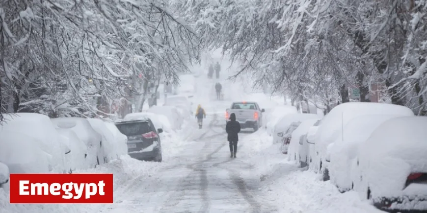
La Niña’s Influence on U.S. Winter Weather
Historically, La Niña spells cooler, wetter winters for the North and milder, drier conditions in the South. The Pacific Northwest often experiences above-average snowpacks, while droughts may persist in the Southwest. The Northern Plains might see harsher winters, and the Great Lakes region generally enjoys increased precipitation. Conversely, the Southeast typically encounters warmer and dryer conditions.
Despite these trends, it’s important to remember that other large-scale atmospheric factors can sometimes deviate from La Niña’s expectations, resulting in unexpected weather patterns such as mild periods in usually cold regions or wetter spells in dry areas.
Impacts on Atlantic Hurricane Seasons
La Niñas traditionally contribute to more active hurricane seasons in the Atlantic due to reduced wind shear. However, this year’s La Niña influence arrives late, likely having minimal impact as the hurricane season winds down.
The Short-Lived Nature of the Current La Niña
This La Niña’s influence is expected to be brief and mild, with sea surface temperatures predicted to remain weak at around -0.9 degrees Celsius below average. Projections suggest a 55% chance of warming ocean waters leading to a neutral ENSO phase by mid-winter. This mirrors last winter’s pattern, which saw a weak, delayed La Niña returning to neutral conditions by spring.
NOAA’s Seasonal Forecast Updates
NOAA has adjusted its seasonal forecasts to align with La Niña’s anticipated effects, predicting lower temperatures in the Northern U.S., especially in the Pacific Northwest, and higher temperatures in the South. The forecasts also anticipate increased precipitation in the North and drier conditions in the South between November and February.
Upcoming updates from NOAA’s Climate Prediction Center, due on October 16, might further reflect La Niña’s impact. As spring approaches, ENSO influences are expected to wane, with neutral conditions predicted to persist into the summer months.


