


Major snowfall predicted for Sierra prompts storm watch for Tahoe and I-80
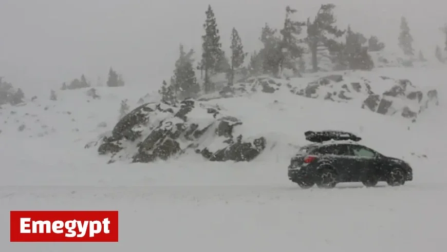
A major snowfall is anticipated in the Sierra region, prompting a winter storm watch for Lake Tahoe and Interstate 80. The National Weather Service has issued the warning from 5 p.m. on Monday, October 13, until 11 a.m. on Wednesday, October 15. Forecasts predict accumulations of 6 to 12 inches above 7,000 feet and up to 2 feet in certain areas along the Sierra crest.
Storm Watch Details
Forecasters highlight that while higher elevations are likely to receive significant snow, the storm’s trajectory will influence how much precipitation falls in the Tahoe area. Currently, Mono County along the crest is expected to see the most snowfall, marking the first significant winter weather impacts for the season. Travelers should be cautious of icy roads, particularly during the early morning hours when snow accumulation is probable.
Travel Precautions
- Be prepared for slick roads on major passes, including:
- Donner Pass
- Carson Pass
- Ebbetts Pass
- Sonora Pass
- Tioga Pass
- Motorists may encounter chain controls and possible road closures.
Weather Forecast for Lake Tahoe
- Sunday: Sunny, with highs of 65°F at the lake and 55°F at higher elevations.
- Monday: Mostly cloudy; high of 51°F. Snow levels rising to 6,500 feet.
- Tuesday: Heavy snow in the morning, high of 46°F.
- Wednesday: Mostly cloudy; high of 49°F.
- Thursday: Clear and warmer; high of 56°F.
- Friday: Clear; high of 64°F.
- Saturday: Mild and sunny; high of 64°F.
Weather Outlook for Reno
- Sunday: Sunny, highs near 65°F.
- Monday: Mostly cloudy; rain likely overnight, highs near 57°F.
- Tuesday: Rain likely; snow levels between 5,800 and 6,400 feet.
- Wednesday: A chance of showers; highs near 53°F.
- Thursday: Sunny and warmer; high near 60°F.
- Friday: Sunny, high in the mid-60s.
- Saturday: Mild and sunny; highs near 67°F.
Forecast at Donner Pass on I-80
A winter storm watch for Donner Pass and the western slope of the Sierra runs from Monday at 11 a.m. to Wednesday at 5 p.m. Heavy snow and strong winds are expected, with forecasts indicating 1 to 3 feet of snow above 6,500 feet.
Travel Considerations
Drivers should remain vigilant during their commutes on Monday and Tuesday, as travel conditions may deteriorate. Chain controls and delays could affect Interstate 80 and Highway 50 routes.
Resources for Travelers
- National Weather Service: Seven-day forecasts and weather alerts available at weather.gov.
- Nevada Department of Transportation: Current road conditions and traffic cameras can be accessed at nvroads.com.
- Caltrans: Highway conditions in California are reported at roads.dot.ca.gov.
- NV Energy: Real-time updates from weather stations are available at nvenergy.westernweathergroup.com.
- ALERTWildfire: Live camera access for current conditions at alertwildfire.org.
Travelers are urged to stay updated with weather forecasts as conditions evolve.


