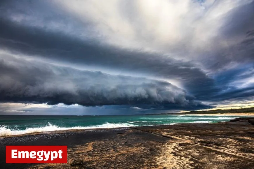
Thunderstorms NSW: Sydney weather flips from spring heat to severe storms today — timing, hazards, and what to do

After a run of unseasonable heat, thunderstorms in NSW are set to fire this afternoon and evening, with Sydney weather primed for a rapid change: gusty squalls, lightning, brief downpours, and pockets of large hail. A southerly change follows tonight, knocking back temperatures but keeping showers around the coast into Saturday.
Weather today: when Sydney should brace for storms
-
Peak storm window: Friday, Oct. 17, from early–mid afternoon through late evening.
-
Hazards: Damaging wind gusts, frequent lightning, short-lived heavy rain, and isolated large hail in stronger cells.
-
Wind shift: Fresh NW winds ahead of storms will swing S/SE behind the change, dropping temperatures and lifting coastal humidity.
Quick read: Expect a warm, breezy late morning, a stormy afternoon/evening, then a cooler, onshore flow overnight.
Where the risk is highest across NSW
-
Sydney Basin & Illawarra: Highest chance late afternoon–evening; any cell that taps stronger upper winds could produce damaging gusts and hail.
-
Central Tablelands & Blue Mountains: Early development possible as surface heating meets upslope flow; storms then drift east toward the coast.
-
Northwest Interior: Scattered severe cells with damaging winds; activity fades slowly overnight as instability eases.
-
South West Slopes/Snowy: Early morning storms have eased, but watch for renewed showers along and behind the change.
Why it’s turning volatile
Two ingredients are colliding:
-
Heat-primed air after several warm days, and
-
An upper disturbance and surface trough adding lift and wind shear.
That combo favors short, sharp thunderstorms that can pulse severe with little warning. As the southerly change pushes up the coast tonight, it will undercut lingering storms and usher in cooler, cleaner air for the weekend.
Saturday and beyond: a cleaner, cooler feel
-
Saturday: Partly cloudy with a slight chance of lingering coastal showers early, then drier and milder through the afternoon.
-
Sunday–Monday: More stable overall; inland warms first, while the coast stays tempered by onshore breezes. Another trough mid-week could re-introduce showers and rumbles.
Travel, events, and outdoor plans
-
Plan B for late-day events: Outdoor sport and concerts should prepare for lightning holds and short postponements.
-
Commuting: The nastiest bursts often coincide with school pick-up and the evening peak; add extra time and avoid flooded dips.
-
Air & ferries: Sudden wind shifts can disrupt schedules; check closer to departure.
Safety checklist for NSW storms
-
Park smart: Move cars under cover where possible to reduce hail damage.
-
Secure loose items: Umbrellas, banners, and lightweight furniture become projectiles in outflow winds.
-
Device prep: Charge phones and power banks; brief blackouts are possible.
-
During lightning: Pause outdoor activity; seek a solid building or fully enclosed vehicle. Avoid trees and open ridgelines.
-
On the road: Never drive through floodwater; vision and traction drop sharply in hail shafts.
At a glance — Sydney weather today
| Period | What to expect | Winds | Notes |
|---|---|---|---|
| Morning | Warm, partly cloudy | NW freshening | UV very high — sun protection needed |
| Early–mid afternoon | Storms bubble inland, drift east | NW 20–30 km/h | First gust fronts arrive |
| Late afternoon–evening | Highest storm risk; hail/wind possible | NW → S/SE 25–40 km/h | Rapid temp drop after change |
| Overnight | Showers easing, cooler | S/SE 20–30 km/h | Improving air quality |
For readers searching weather today, weather sydney, and weatherzone
If you’re tracking every radar sweep: set alerts for your suburb, enable lightning notifications, and keep an eye on storm tops racing in from the west and northwest. Radar can look quiet until cells rapidly intensify within 30–60 minutes of arrival — that’s typical on hot, unstable days like this.
Thunderstorms in NSW will be hit-and-miss but locally intense this afternoon and evening, especially for Sydney and nearby ranges. Build in flexibility, secure what can blow or dent, and be ready to pause plans during the worst of it. The payoff is a cooler, cleaner weekend on the other side of tonight’s change.


