


Hail storm Brisbane: giant hail and damaging winds lash South East Queensland
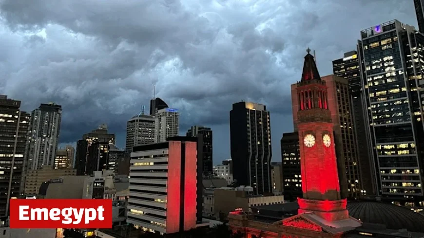
A fast-moving outbreak of severe thunderstorms struck Brisbane and surrounding parts of South East Queensland on Saturday, bringing a dramatic hail storm to Brisbane’s suburbs, destructive wind gusts, and bursts of very heavy rain. The volatile setup produced hailstones widely in the 2–4 cm range, with isolated reports near or above 5 cm as supercell thunderstorms tracked from the Scenic Rim and Border Ranges toward the city and bayside, then on to the Sunshine Coast. Power interruptions, traffic delays, and brief venue closures followed as the worst cells pulsed through during the afternoon and early evening.
Where the hail storm in Brisbane hit hardest
Large hail was observed across multiple corridors as separate cells flared, merged, and weakened:
-
Southwest & southern fringe: Cedar Grove, Collingwood Park, and areas near Mt Lindesay saw 2–4 cm hail mid-afternoon.
-
Scenic Rim to Logan: A particularly intense core near Rathdowney produced large to possibly giant hail before tracking northeast toward Logan Village and Beenleigh.
-
Western & northern approaches: Lake Manchester, Upper Brookfield, Enoggera Reservoir, and Samford were in the firing line as a very dangerous thunderstorm moved north.
-
Moreton Bay to Sunshine Coast: Late-day cells produced severe hail signatures near Caboolture, with a destructive storm moving off the coast north of Caloundra.
Thousands of customers briefly lost power at peak, with the worst interruptions concentrated across coastal and near-coastal suburbs. Hail damage ranged from dented car panels and cracked windscreens to shredded foliage and perforated shade sails.
Why the Brisbane hail storm escalated so quickly
Saturday’s event formed on a surface trough pushing through southeast Queensland that tapped into:
-
High instability: Warm, humid surface air overlaid by cooler temperatures aloft primed strong updrafts.
-
Wind shear: Changing wind speed and direction with height supported rotating updrafts (supercells), the classic engine for large and giant hail.
-
Trigger lines: Converging sea-breeze boundaries and the southeasterly change focused initiation and helped storms repeatedly redevelop.
This “right mix of ingredients” allowed storms to intensify rapidly, producing overshooting tops on radar and satellite, severe hail cores, and localised destructive wind bursts.
Hail storm Brisbane: impacts, travel and events
-
Transport: Short-lived but intense downpours cut visibility on major arterials. Hail accumulation made surfaces slick in pockets, with minor prang reports and slow-moving traffic around storm passages.
-
Events & venues: Outdoor gatherings paused during the strongest cells; some sites temporarily suspended trading or entry while lightning and hail passed.
-
Property: Motorists caught in the open copped the brunt—panels, windscreens, and plastic trims. Garden beds and soft roofing materials suffered pitting where hail exceeded golf-ball size.
If your vehicle or roof was hit, document damage with time-stamped photos and lodge claims promptly; many insurers triage on event date and suburb.
What’s next for Brisbane after the hail
While the most intense activity eased during the evening, lingering showers and isolated rumbles remained possible as outflow boundaries drifted offshore. Into Sunday, the broader pattern still supports showers and the chance of a storm, but with a lower probability of giant hail for the metro compared with Saturday’s peak. Inland districts may keep a risk window if heating and shear realign during the afternoon.
Residents should monitor official warnings through the evening and early Sunday in case any residual cells redevelop along the coast or hinterland.
Safety checklist for the next storm pulse
-
Shelter vehicles early. If storms are on approach, move cars under cover—don’t wait for the first drops.
-
Stay off flooded roads. Localised flash flooding can hide debris; turn around rather than driving through.
-
Avoid trees and powerlines. Wind bursts can drop branches; treat all fallen lines as live.
-
Secure loose items. Outdoor furniture and trampolines become projectiles in outflow winds.
-
Track warnings. Keep push alerts on for severe thunderstorm updates and hail advisories.
Timeline: Saturday’s hail storm across Brisbane (local time)
-
Early afternoon: Severe cells erupt over the Scenic Rim; hail 3–4 cm observed near Rathdowney and Cedar Grove.
-
Mid-afternoon: Very dangerous storm detected west of Brisbane, moving toward Samford and the northern suburbs.
-
Late afternoon: Hail cores track through Logan/Beenleigh corridor and into Moreton Bay; additional cell intensifies north of Brisbane.
-
Early evening: Strongest activity shifts toward the Sunshine Coast hinterland and offshore; warnings begin to wind back as storms weaken.
The hail storm in Brisbane delivered a textbook spring severe-weather burst: rapid supercell development, large to locally giant hail, and damaging winds. While the worst has likely passed for now, the broader pattern remains unsettled. Keep your weather apps active, plan early shelter for vehicles, and be prepared to pause outdoor plans if new cells bubble up on short notice.


