Gusty Storms with Heavy Rainfall to Hit the Mid-Atlantic Region

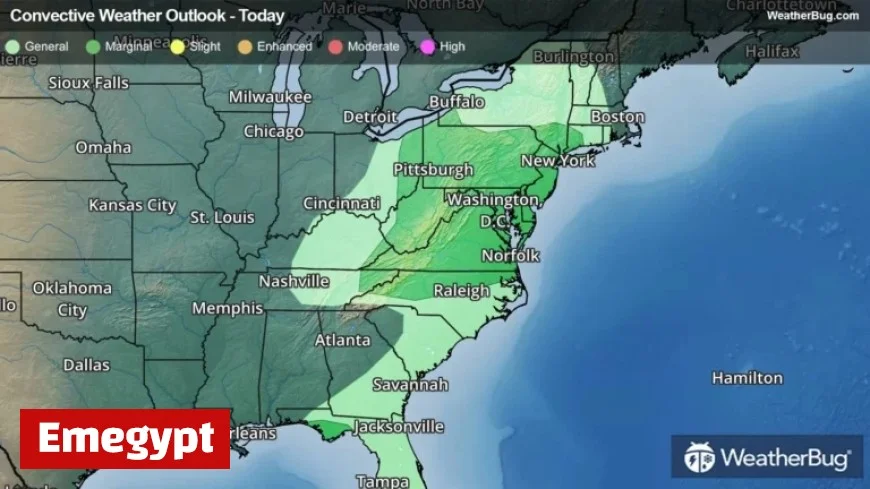
Gusty storms with heavy rainfall are expected to impact the Mid-Atlantic region today as a powerful cold front moves through the Eastern United States. A significant low-pressure system is traversing from the Great Lakes toward southeastern Canada, dragging along the cold front and causing a clash of air masses. An influx of mild, humid air precedes the front, while colder, drier air follows.
Weather Conditions Ahead of the Cold Front
As this collision of air masses occurs, areas in the Mid-Atlantic will experience gusty rain showers and thunderstorms. The timing for these storms is expected to peak in the evening and continue into the overnight hours.
Areas at Risk
- The central Gulf Coast
- The central Appalachians
- Mid-Atlantic
Wind gusts between 40 to 50 mph are likely with these thunderstorms. Additionally, isolated higher gusts could reach up to 50 mph, particularly in storm-affected zones. A brief, isolated tornado is also a potential hazard, especially from the northern Mid-Atlantic extending into southern New England.
Forward Outlook: Continuing Effects
As we advance into Monday, another low-pressure system may develop along the cold front. Regions that will still feel the impact include the Northeast and parts of central and southern Florida. Forecasts indicate persistent rounds of moderate to heavy rainfall, raising concerns for localized flooding that could develop in some areas.
Preparation and Safety Tips
Residents are urged to prepare for the incoming severe weather. Here are some safety guidelines:
- Have a severe weather kit ready, including a battery-operated radio.
- Stock up on water and non-perishable food items.
- Stay informed using weather apps like WeatherBug for updates.
Remember, staying indoors is crucial during severe weather conditions. The mantra, “When Thunder Roars, Go Indoors!” serves as a vital reminder.


