


Stay Prepared: Cool Breezes and Lake Effect Rain Expected This Week
Cool breezes and lake effect rain are expected in Rochester, New York, this week as a significant upper-level low approaches the region. This weather pattern will lead to below-average temperatures and unsettled conditions.
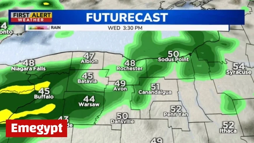
Weather Forecast Overview
The upper-level low will settle over Rochester starting Tuesday night. This system will influence the weather for several days, bringing cooler temperatures and frequent rainfall. Although rain showers will begin late Tuesday night, the impact will be felt most significantly on Wednesday.
Wednesday Forecast
- Showers are expected to start after midnight, resulting in a damp Wednesday morning.
- Although not a complete washout, intermittent lake effect rain will occur, primarily in areas west and south of Rochester, particularly influenced by Lake Erie.
- Temperatures will remain cool, with highs around 50°F and southwest winds gusting up to 30 mph.
Thursday Conditions
Conditions on Thursday will mirror those of Wednesday, featuring scattered rain showers and brisk breezes. Cool temperatures will persist, contributing to the overall autumn feel in the air.
Rainfall Potential
As the upper-level low gradually releases its hold on the area by Friday, rain showers are expected to become less frequent, although they may continue to affect the western Southern Tier and Tug Hill. This region could see several inches of rainfall by week’s end.
Weekend Outlook
- Rain chances will decrease significantly, with a slight possibility of isolated showers on Saturday.
- Temperatures will remain cooler than usual throughout the weekend.
- On Sunday, fair weather is anticipated, which may extend into the early part of the following week.
This week’s weather will highlight the characteristic cool breezes and lake effect rain that define the fall season in upstate New York. Residents and visitors should prepare for these changing conditions as the week progresses.


