


Severe Thunderstorm and Flood Alerts Issued for North Texas
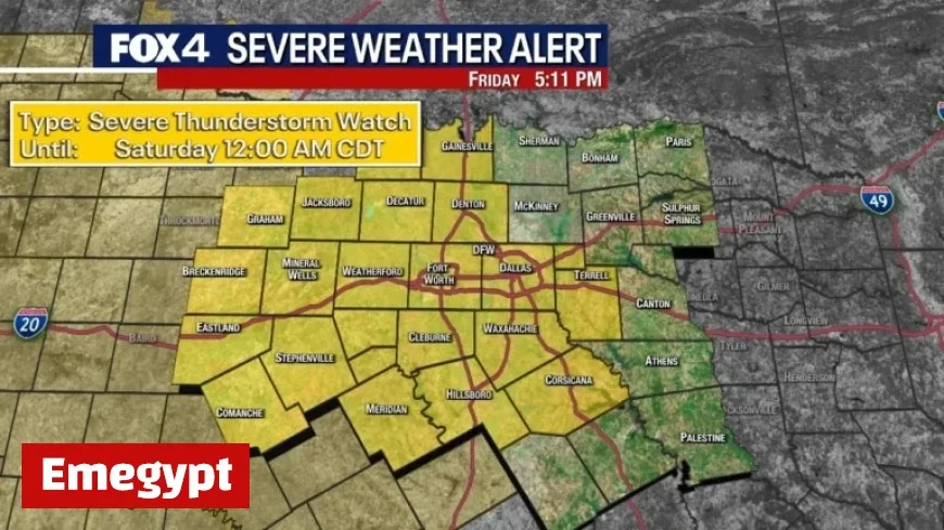
North Texas is currently under severe thunderstorm and flood alerts following a significant round of storms. A severe thunderstorm watch has been issued for the area, effective until at least midnight.
Severe Thunderstorm Conditions
On Friday evening, the region faced a brief tornado warning specifically targeting Palo Pinto County. The most intense weather activity is expected to arrive after sunset in areas west of the Dallas-Fort Worth (DFW) metroplex.
Timing and Risks
The main disturbance is anticipated between 9 p.m. and 10 p.m. for the Metroplex. The primary threats include:
- High winds
- Possible hail up to the size of a quarter
- A slight risk of tornadoes in western areas
The National Weather Service forecasts widespread rainfall totals ranging from 1 to 3 inches, with isolated locations potentially receiving up to 5 inches. A Flood Watch is currently active from 7 p.m. on Friday until 1 p.m. on Saturday.
Weekend Weather Outlook
Saturday morning will likely experience dry conditions. However, temperatures are expected to rise into the 70s. Another disturbance may bring additional showers and storms in the afternoon, particularly south of DFW. At this time, these Saturday storms are not forecasted to reach severe levels.
Sunday and Beyond
Sunday will start with overcast skies and lingering showers in eastern North Texas. Conditions will improve as clouds dissipate, leading to pleasant fall weather with temperatures stabilizing in the 70s.
7-Day Forecast
The upcoming week will see milder temperatures, with Monday expected to remain in the 70s. Tuesday will be breezy with partly sunny conditions. Cooler air is projected to settle in mid-week, with Wednesday likely being the chilliest day under sunny skies and lighter winds.
Stay updated on weather conditions and monitor alerts as the weekend progresses.


