


Incoming Storms Approach as Tornado Watch Continues
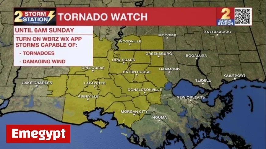
As hazardous weather approaches, several regions in Louisiana are under a Tornado Watch. This alert extends to East Baton Rouge, West Baton Rouge, Ascension, Assumption, Iberville, East Feliciana, Livingston, Pointe Coupee, St. Helena, St. James, St. Mary, West Feliciana Parishes, as well as Amite and Wilkinson Counties. The watch is effective until 6 a.m. on Sunday.
Current Weather Conditions
While scattered showers have been reported, the strongest line of thunderstorms remains positioned west of Baton Rouge. Over the past hours, some areas in southwest Louisiana have experienced Severe Thunderstorm and Tornado Warnings.
A tornado has likely caused damage in Sulphur, LA. Though there are signs that the intensity of these storms may be weakening, conditions remain volatile.
Forecast for Baton Rouge and Surrounding Areas
The main line of storms is expected to impact the Capital Area between 2 a.m. and 5 a.m. Ahead of this line, isolated thunderstorms are likely to develop. Meteorologists are particularly concerned about damaging winds and the potential for brief tornadoes.
- 1-3 inches of additional rain expected.
- Some locations may receive higher totals.
- Rain is anticipated to subside after sunrise on Sunday.
- High temperatures may reach around 80°F.
After a night of storms, the weather will improve throughout Sunday. Rain is expected to clear, with only isolated thunderstorms occurring in the afternoon. Temperatures will head toward a high near 80°F, with skies showing signs of clearing.
Upcoming Weather Changes
As the week progresses, humidity levels will drop, creating a more pleasant atmosphere. Highs will stabilize around 80°F, while nighttime lows will hover near 60°F. A strong cold front is anticipated on Tuesday night, which could lead to a drop in temperatures.
- Daytime highs in the 60s on Wednesday and Thursday.
- Lows projected in the low to mid-40s by the week’s end.
- Cooler temperatures expected for Halloween.
Tropical Developments
In related news, Hurricane Melissa has rapidly intensified and is currently a major hurricane. As of Saturday evening, Melissa has started drifting westward near Jamaica. The storm may reach Category 5 status by Monday, posing significant risks of damaging winds and heavy rainfall.
After potentially impacting Jamaica, Melissa is forecasted to move towards eastern Cuba and the southeastern Bahamas, with life-threatening flash flooding and landslides likely to occur.
For ongoing weather updates, visit Emegypt for the latest news, including a detailed 7-day forecast and real-time alerts.


