


Tornado Watch Issued for Capital Region Amid Overnight Storms
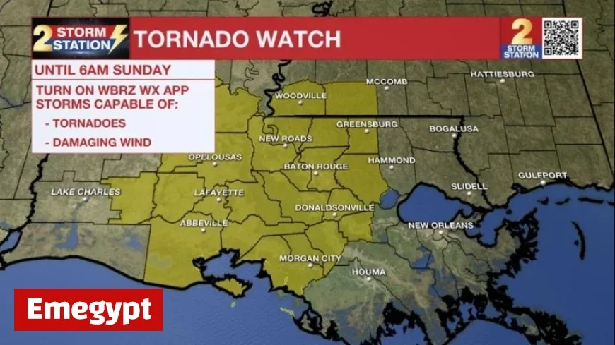
The National Weather Service has issued a Tornado Watch for the Capital Region amid ongoing severe weather conditions. This alert remains in effect until 6 a.m. on Sunday and covers several parishes and counties, including East Baton Rouge, West Baton Rouge, Ascension, and others.
Tornado Watch Details
As thunderstorms move through the area, the weather service warns residents in the following locations to be vigilant:
- East Baton Rouge Parish
- West Baton Rouge Parish
- Ascension Parish
- Assumption Parish
- Iberville Parish
- East Feliciana Parish
- Livingston Parish
- Pointe Coupee Parish
- St. Helena Parish
- St. James Parish
- St. Mary Parish
- West Feliciana Parish
- Amite County
- Wilkinson County
Conditions Favorable for Tornadoes
A Tornado Watch indicates that conditions are right for the development of tornadoes and damaging winds in the area. Residents are advised to remain alert for potential severe weather forecast updates.
People should prepare to take shelter in a low-level interior room of a sturdy building if a tornado warning is issued. Important safety measures include:
- Bringing pets along on a leash.
- Wearing hard-soled shoes.
- Monitoring storm updates on a wireless device.
- Covering one’s head in case of wind or debris impact.
Upcoming Weather Forecast
Thunderstorms are expected to reach the Capital Area between 2 a.m. and 5 a.m., with isolated activity occurring earlier. Although most areas may avoid severe weather, isolated strong storms could produce damaging winds and brief tornadoes.
Rainfall Expectations
Forecasters predict an additional 1 to 3 inches of rain across the region. While this precipitation is generally beneficial, quick downpours could lead to localized flooding.
Looking Ahead
As the storms subside on Sunday morning, only light rain and spotty thunderstorms are expected in the afternoon. The temperatures will rise, nearing the 80-degree mark.
Humidity levels are forecast to decline in the following days, with daytime highs leveling off around 80 degrees and nightly lows near 60 degrees. A significant cold front is set to pass Tuesday night, bringing a notable temperature drop.
Halloween Weather Outlook
This coming Halloween may be cooler than usual, with temperatures expected to fall into the 50s during trick-or-treating hours.
Stay informed about the latest weather developments and updates through Emegypt and other local news sources.


