


Mild Sunday Precedes Week’s Cooler Start: Key Weather Insights
A warming trend has begun in Central Florida as a significant weather system approaches. This upper-level low is expected to create a weak low-pressure area off the Southeast coast, leading to cooler temperatures later in the week.
Mild Sunday Precedes Week’s Cooler Start
On Sunday, high pressure will keep conditions stable. Light winds from the north to northeast, around 5-10 mph, will prevail. While most areas will remain dry, isolated showers could occur later in the day.
Weather Forecast for the Weekend
- Sunday Temperatures: Highs in the upper 70s to low 80s.
- Rain Chances: 20-30% for isolated to scattered showers late Sunday into Monday.
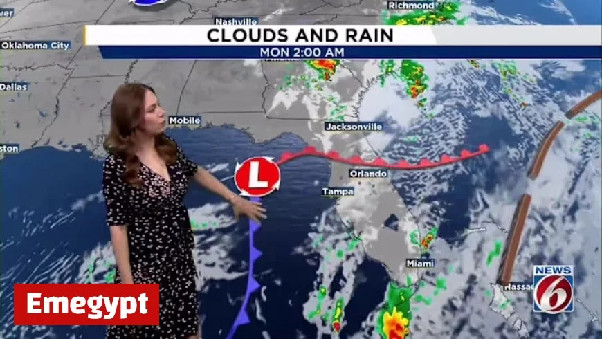
Monday will mark a transition as cooler air moves in following the frontal system. High temperatures will drop into the low to mid-70s. Overnight lows will range from the mid-50s to low 60s, dipping further across most areas by Monday night.
Weather Outlook: Tuesday to Saturday
From Tuesday through Saturday, forecasts indicate that high pressure will dominate the Southeast. This should lead to predominantly dry weather.
- Tuesday Winds: Light winds from the north to northeast at 10-15 mph.
- Later in the Week: Possible light coastal showers but no widespread rain expected.
Temperatures are projected to gradually increase, with mid to upper 70s on Tuesday, reaching the 80s by the weekend.
Stay informed and prepared as the week progresses, and enjoy the mild Sunday before the cooler temperatures set in.


