


Power Outages and Floods Loom as Wicked Weather Bomb Targets November with Record Low Pressure
St. John’s, Newfoundland and Labrador, is expected to experience record low-pressure conditions this November. The area is bracing for a potent weather system that may lead to power outages and flooding.
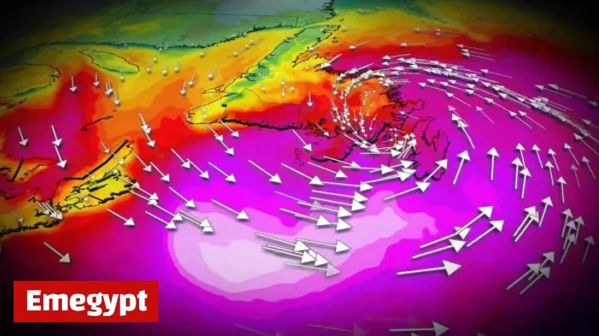
Forecast Overview
The National Weather Service predicts that St. John’s will likely break the November low-pressure record. This event could see sustained winds of 80 km/h across southeastern Avalon, with gusts potentially exceeding 120 km/h by Tuesday evening.
Wind Warnings in Effect
- Date of Concern: Tuesday evening.
- Predicted Gusts: More than 120 km/h.
- Previous Records: Gusts above 100 km/h were last recorded on February 15, and those exceeding 110 km/h occurred on January 5.
Expected Rainfall and Impacts
Heavy rainfall is predicted primarily north of the storm’s path. Areas including Cape Breton, Nova Scotia, and central and western Newfoundland may receive 30-60 mm of rain, with localized higher totals possible.
Potential Hazards
- Power Outages: Likely due to strong winds and downed trees.
- Localized Flooding: Anticipated in various regions, particularly in Cape Breton and Newfoundland.
- Coastal Erosion: Significant threat from waves reaching heights of 6-8 meters.
Looking Ahead
By Wednesday morning, the severe system is expected to move northeast of the province. Winds will begin to ease, and rain will become less intense throughout the day.
Residents are advised to monitor the evolving conditions closely, as the weather may pose risks to travel and infrastructure. Stay informed for further updates regarding this weather bomb and its potential impacts on Atlantic Canada.


