


Chicago Weather Update: First Snowflakes of Season Set for Weekend Arrival
Chicago residents should prepare for a significant weather shift this weekend, as the first snowflakes of the season are set to arrive. An approaching storm system will bring rain late tonight, continuing into early Friday morning.
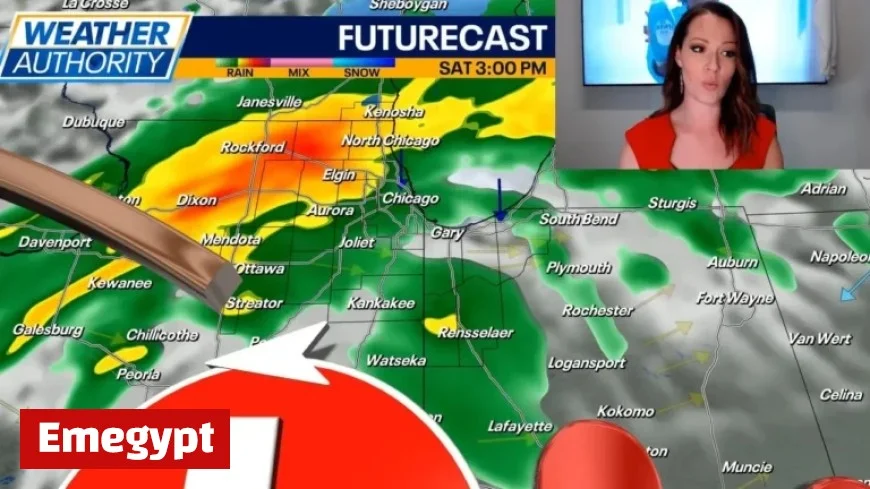
Weather Forecast Overview
Most areas can expect approximately a quarter-inch of rain before the skies clear by dawn on Friday. The day is expected to be pleasant, with mostly sunny to partly cloudy conditions. High temperatures will reach the lower 60s, but winds will intensify, gusting up to 30 mph from the west.
Weekend Weather Changes
As the weekend approaches, temperatures will drop significantly. On Saturday, highs will reach only the upper 40s to near 50 degrees. Rain is anticipated to begin by late morning or around midday, continuing through the afternoon and into the evening.
- Rain showers may transition to snow as temperatures fall.
- Minor slushy accumulations are possible on grassy and elevated surfaces.
Colder Temperatures Ahead
Sunday and Monday will bring even colder conditions, with high temperatures only in the 30s. Lake effect snow showers may occur on both days, though their timing and location remain uncertain. Currently, it seems that Northwest Indiana will experience the brunt of this activity, but northeastern Illinois may observe some rain or snow if winds shift to a more northeasterly direction.
Upcoming Weather Patterns
Looking ahead to next week, slightly warmer temperatures are projected to return on Tuesday and Wednesday. Veterans Day is anticipated to be mostly cloudy, with high temperatures in the mid-40s. By Wednesday, temperatures are expected to rise into the mid-50s, accompanied by partly cloudy skies.
Residents are encouraged to monitor weather updates as conditions continue to evolve. Prepare for the first snowflakes of the season and stay warm in the cold temperatures ahead.


