


Winter Weather Advisory Extends in NW Indiana Amid Persistent Lake-Effect Snow
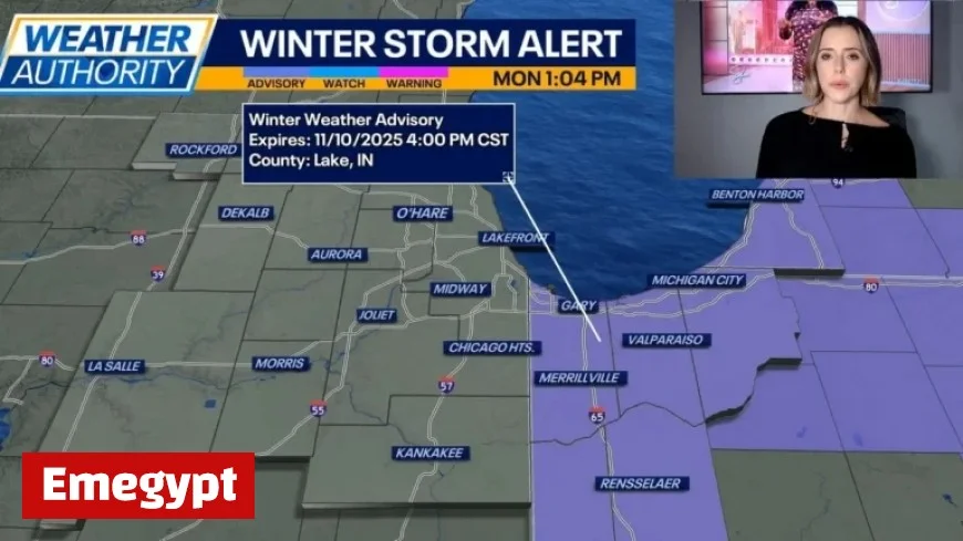
Northwest Indiana is currently experiencing significant lake-effect snowfall, leading to challenging driving conditions and visibility issues. A winter weather advisory remains in effect as residents face additional accumulations of 1 to 3 inches of snow throughout the day.
Current Weather Conditions
Temperatures in the region are cold, with highs only reaching the 30s. Wind chills make it feel even cooler, dropping into the teens and 20s. Wind gusts between 25 and 30 mph contribute to the harsh conditions.
Forecast Ahead
Looking towards tomorrow, early light snow is expected, with temperatures in the upper 30s to low 40s. The rest of the week promises a shift in weather patterns.
- Wednesday: Sunny skies with temperatures around 50 degrees.
- Thursday: Mostly sunny conditions will prevail, with highs in the mid-50s.
- Friday: Partially sunny, reaching the upper 50s.
Weekend Outlook
The upcoming weekend is set to be warmer, although rain is anticipated. Saturday will be mostly cloudy, with temperatures in the low 60s. Rain is likely to return late Saturday night into Sunday.
Sunday Weather
On Sunday, temperatures will remain in the upper 50s, continuing the trend of variable weather. Residents are advised to stay updated as conditions evolve throughout the week.


