


Freezing Rain and Icy Roads Prompt Winter Advisory for WNC
Parts of western North Carolina are bracing for winter weather conditions tonight and into early Tuesday. A storm moving in from the Gulf Coast is expected to bring cold rain, with pockets of freezing rain potentially creating icy spots on the roads. This weather event is predicted to start causing travel disruptions on December 2, 2025.
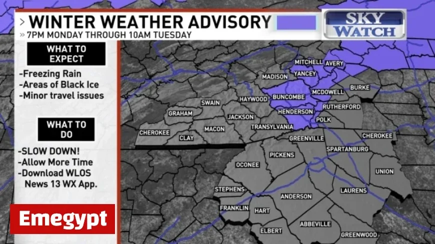
Winter Weather Advisory Issued for Western North Carolina
The National Weather Service has issued a Winter Weather Advisory due to the risk of freezing rain. This advisory is effective from 7 p.m. Monday to 10 a.m. Tuesday. It covers several counties, including:
- Avery
- Buncombe
- Henderson
- Mitchell
- Yancey
- Burke
- McDowell
- Polk
- Rutherford Mountains
Advisory Recommendations
Residents in the advisory area are advised to limit travel, as black ice poses significant risks. Those who must travel should drive cautiously and allocate extra time to reach their destinations safely.
Expected Conditions and Accumulation
As the night progresses, higher elevations may experience slick surfaces even outside the advisory areas. Most temperatures are predicted to rise slightly, likely remaining above freezing by 7 a.m. Tuesday. However, some northern mountain areas, such as Burnsville and Mount Mitchell, may see ice accumulation of up to a tenth of an inch.
Travelers and residents in western North Carolina should remain vigilant as winter weather impacts the region. Stay informed about local weather updates and road conditions to ensure safe travel.


