


Snow Ends Tonight, Slick Roads Persist
The recent snowfall has come to an end, but residents of Kansas City should remain cautious. Slick roads may continue to pose risks due to freezing fog.
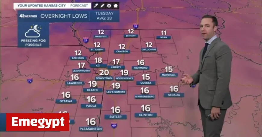
Weather Overview for Kansas City
As we transition into the week, warmer temperatures are expected on Tuesday and Wednesday. However, a significant cold front is anticipated, bringing colder air later in the week.
Forecast Details
- Tonight: The sky will clear up, but freezing fog might develop, particularly affecting elevated surfaces. The low will drop to 18°F, with a light south-southwest wind at 5-10 mph.
- Tuesday: Freezing fog should clear by 10 AM. Expect partly cloudy skies and warmer temperatures throughout the day. The high will reach 34°F, with winds from the south-southwest at 10-15 mph. Be cautious of refreezing conditions after 3-4 PM.
- Wednesday: A mostly cloudy day is expected, with a strong cold front arriving in the afternoon. The temperature will start at a low of 27°F and peak at 36°F, but it will feel close to 20°F by 6 PM. Winds will shift to the north at 15-30 mph.
Future Weather Patterns
Looking ahead, the next storm system may impact the region this weekend. Residents are encouraged to stay tuned for updates on weather conditions and prepare for any travel difficulties.
For the latest weather information, keep an eye on the interactive radar and follow our ongoing updates.


