


Heavy Rain to Sweep Florida: Orlando Weather Expectations
A developing low-pressure system over the northern Gulf will significantly affect Orlando’s weather. On Tuesday, this system is expected to move northeast, bringing a cold front through Central Florida by the afternoon.
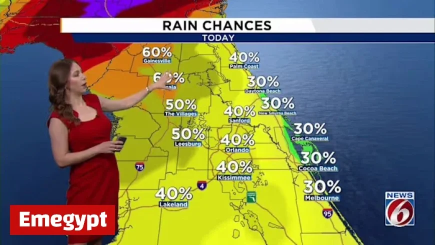
Heavy Rain and Thunderstorms for Orlando
As the front approaches, scattered showers and thunderstorms are likely throughout the day. Most precipitation is anticipated to cease around sunset as the storms move offshore. Rainfall may come with brief, intense bursts, accompanied by lightning and strong wind gusts ranging from 40 to 55 mph.
Temperature Expectations
Before the front’s arrival, temperatures will remain above normal. Highs could peak in the low to mid-80s. Once the front passes, overnight lows are projected to drop into the mid-50s in areas north and west of Interstate 4.
Midweek Weather Conditions
Following the cold front, Central Florida will experience a brief respite. High pressure is expected to dominate the weather through Friday. During this period, temperatures will feel more seasonal, with highs near I-4 in the low 70s and mid-to-upper 70s in southern areas. Expect cooler nights with lows sliding into the upper 40s to around 50 degrees.
Upcoming Weather System
Another weather system will approach over the weekend, originating from the western Gulf. Forecast models suggest this new cold front will reach Florida between Saturday night and Sunday. As it draws closer, moisture will elevate rain chances to 30-40%.
- Saturday: Highs will stay warm, in the upper 70s to low 80s.
- Sunday: Temperatures will fall back into the 70s after the front’s passage.
Stay informed with Emegypt as the weather changes, ensuring you are prepared for potential heavy rain and stormy conditions in Orlando.


