


Kansas City Enjoys a Break from Frigid Temperatures with Warm Air Arrival How Long Will It Stay
Kansas City is set to experience a temporary respite from cold temperatures over the next few days. A storm system is approaching, though it is unlikely to cause significant weather in the area. Here’s a closer look at what to expect.
Kansas City Weather Overview
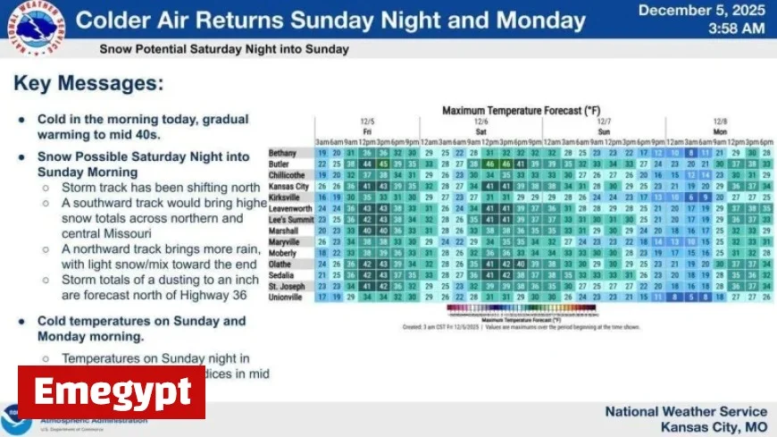
According to the National Weather Service, wind chill values for Friday morning are forecasted to be in the single digits and teens. However, temperatures are expected to rise throughout the day, reaching highs between 35°F and 45°F.
Friday’s Forecast
- Morning wind chills: Single digits to teens
- Afternoon high: Approximately 43°F
- Wind: Southwest at gusts up to 20 mph
- Condition: Mostly cloudy
Weekend Weather Outlook
The forecast for Saturday suggests that a storm system may pass north of Kansas City. This will contribute to minimal chances of rain and snow. Areas north of Highway 36 could see a dusting of snow, while regions south may encounter a wintry mix without accumulation.
- Saturday’s high: Near 42°F
- Wind: Calm from the southwest
- Overnight low Saturday: Around 26°F
Cold Air Returns
Despite the warm air moving in temporarily, cold conditions are expected to return. On Sunday, the forecast predicts a high of about 31°F. North winds blowing at around 8 to 11 mph will cause the wind chill to feel even colder.
- Sunday’s forecast high: Approximately 31°F
- Possible wind gusts: Up to 21 mph
- Overnight wind chill values: Mid-teens
In summary, Kansas City will enjoy a brief break from frigid temperatures with the arrival of warmer air over the next few days. Yet, residents should prepare for a return to cold weather by Sunday. Stay updated with weather forecasts for any changes.


